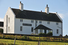
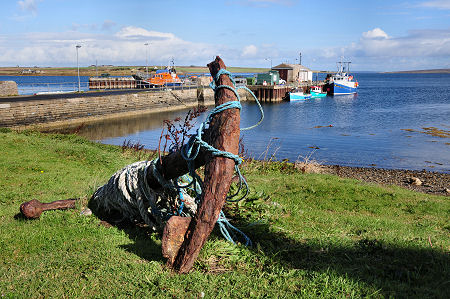
 Longhope Pier |
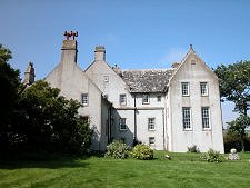
What's normally thought of as Hoy's largest settlement, Longhope, isn't really on Hoy at all. It sits on the north shore of South Walls, which was a separate tidal island finally connected to Hoy by a short causeway, the Ayre, in 1912. Just to the east of the Ayre is Melsetter House, Hoy's finest house.
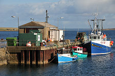
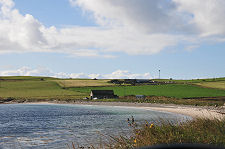
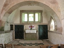
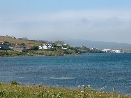
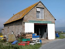
The village of Longhope straggles along the shore near the mouth of the sheltered anchorage, known as Longhope and North Bay, which forms part of Scapa Flow and bites deeply between South Walls and North Walls. The focus of the village is the harbour at South Ness, once home to a ferry service across to North Ness in North Walls. At its east end is St Columba's Church which now serves much of Hoy.
The name Longhope comes fairly directly from the Old Norse for "long bay" and it comes as little surprise that the Vikings made use of the shelter it afforded 1,000 years ago. But they were not the first to settle here: the remains of a number of brochs around the coast of South Walls show others had been living here at least as far back as the Iron Age.
In more recent history the inlet of Longhope became an important gathering place for convoys during the Napoleonic Wars before they set off around the north and west coast of the UK to avoid French warships in the North Sea and Channel. It was protected from French and US privateers by the guns of the Hackness Battery and the Martello Towers placed either side of the mouth of the inlet. (Continues below image...)
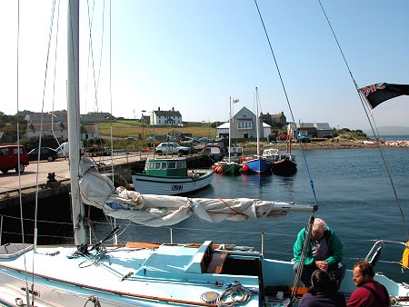 Longhope from its Pier |
As a result of all this activity the village of Longhope thrived. In 1814 Sir Walter Scott wrote: "Longhope will one day become a flourishing place; there will soon be taverns and slop shops, where sailors rendezvous in such numbers; then will come quays, docks and warehouses; and then a thriving town." Perhaps this was wishful thinking from a man who was on record as disliking Stromness because the steps in its main street obstructed his carriage: but Sir Walter was wrong and it was Stromness that saw the later growth.
Longhope inevitably saw its share of the changes that swept across Hoy as a result of intense naval activity in the two world wars and a vast influx of military personnel who, in WWII, outnumbered the pre-war covilian population across Orkney as a whole by 2-1. After WWII, Longhope's population declined alongside that of Hoy. more widely.
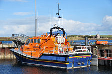
As its very name suggests, Longhope's fortunes have been closely connected to the sea throughout its history. This brought tragedy on 17 March 1969 when the Longhope Lifeboat, the T.G.B. (thought to be the initials of the anonymous sponsor who funded it), launched into the teeth of a storm to assist the Liberian-registered vessel Irene, which had been driven aground off the shore of South Ronaldsay.
The T.G.B. was caught and capsized by a huge wave. The vessel was of a type that did not right itself if capsized, and although the lifeboat was later recovered, the crew of eight were all killed.
The disaster is commemorated by a bronze memorial in the Kirkhope burial ground, set amid the graves of those who died and looking out across the southern end of Scapa Flow towards South Ronaldsay. At the other end of South Walls, overlooking the Ayre on the Hoy. side of Aith Hope a Longhope Lifeboat Museum has been created in the lifeboat station from which the T.G.B. was launched (these days the lifeboat is moored in Longhope itself). What adds further to the sense of tragedy is that the T.G.B. itself was subsequently returned to service and spent a further eight years based in Ireland. Today it is preserved in the Scottish Maritime Museum at Irvine.
 Longhope Seen from the East |

|
|
|
Visitor InformationView Location on MapWhat3Words Location: ///walks.dislodge.huddling |
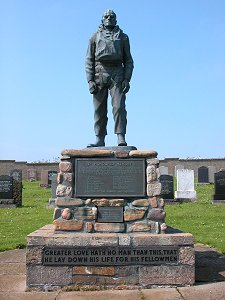 Lifeboat Memorial |
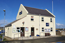
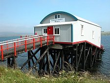 Longhope Lifeboat Museum |
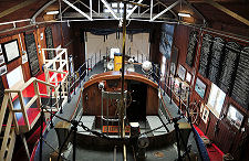 Inside the Lifeboat Museum |
 Original Lifeboat Station by Ayre |
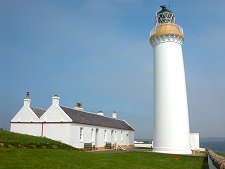 Cantick Head Lighthouse |
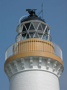 Cantick Head Lighthouse |
 Old Tractor |