 Excise Street |
Kincardine, or Kincardine on Forth to give it its full name, is a large village on the north side of the Forth at the point it narrows from estuary to river. As a result it is perhaps best known for giving its name to the Kincardine Bridge, the road bridge built to cross the Forth in 1936. When it was built, the Kincardine Bridge was the longest swing bridge in Europe, which allowed ships to continue up the river to Alloa and Stirling. The bridge has not swung since 1988 and only small craft now go further upriver.
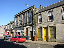
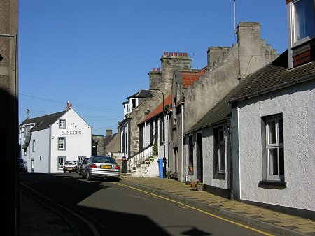
To those who only know Kincardine from its bridge, it comes as a surprise to find that hiding behind the approach roads is an attractive village with considerable character reflecting its history as a long standing trading port. The survival of the heart of Kincardine is particularly remarkable given developments over the last hundred years. In 1900 this was still no more than a small river port with a steam ferry plying across the Forth. Coal was being mined extensively in the surrounding area, but to all intents and purposes this was the same village it had been in 1800.
But in 1906 the railway line from Alloa to Culross effectively cut Kincardine off from its river frontage and its piers. Then the Kincardine Bridge opened in 1936, taking traffic along a road that effectively chopped off the eastern side of the village from the centre. At some point another road, running between Dunfermline and Alloa, chopped off the north side of the village from the centre.
And if the carving up of the village was not enough, a site just to its west was chosen in 1952 for the Kincardine power station, which when it opened in 1960 used locally produced coal to generate up to one third of Scotland's electricity. Three tower blocks were built in Kincardine to house workers from the power station. Two years later work began on the Longannet power station two miles south-east of the village along the bank of the Forth. This opened in 1973 and consumed 10,000 tonnes of coal daily.
But times change. The Kincardine power station closed and was demolished in 2001. And the deep coal mining industry in Scotland has now gone, with the country's last deep mine, at Longannet, closing in 2002. The Longannet power station was converted to burn imported coal; and has itself since closed.
The new millennium has brought more positive changes. In 2004, a new road opened to the east of the village, taking part of the traffic from the Kincardine Bridge away from Kincardine altogether. And in November 2008 a new bridge opened. The Upper Forth Crossing, now called the Clackmannanshire Bridge, picks up traffic from Clackmannan and Alloa well to the west of Kincardine and carries it across to the south bank without it needing to come near Kincardine. The result of these developments is that Kincardine seems likely to be a quieter and more pleasant place, no longer carved into segments by roads carrying large volumes of traffic.
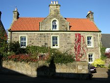
And for those wanting to explore a little, Kincardine is home to Tulliallan Kirkyard, which has one of the best, and best looked after, collections of old Scottish gravestones anywhere in the country.
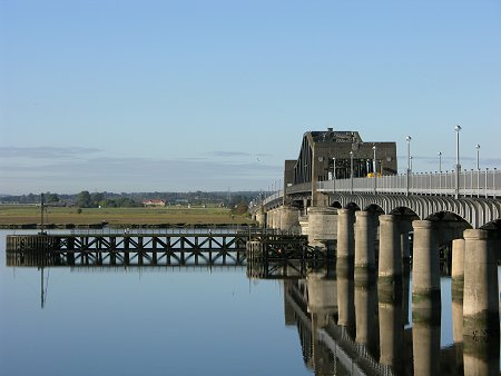 The Kincardine Bridge |

|
|
|
Visitor InformationView Location on MapWhat3Words Location: ///castle.mallets.dote |
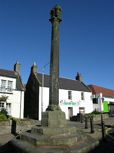 The Mercat Cross |
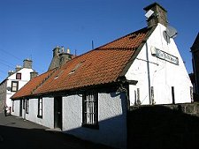 The Auld Hoose |
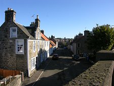 View from the Bridge Approach |