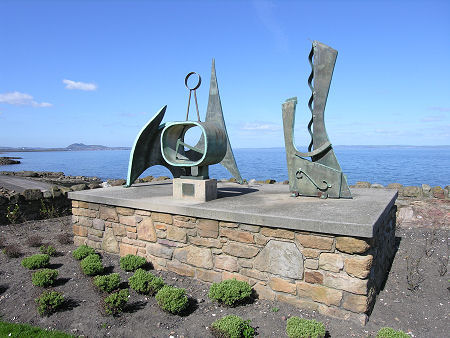
 Sculpture by Leslie Frank Chorley: with Arthur's Seat in the Distance |
Prestonpans lies on the south coast of the Firth of Forth and looks across a broad bay formed by this bank of the river towards Leith and Edinburgh, both eight miles to the west. More locally it lies two and a half miles north-east of Musselburgh, and a mile south-west of Cockenzie.
Prestonpans once formed one of three local settlements, the others being Preston, half a mile inland, and Prestongrange, along the coast to the south-west. Today's Prestonpans has largely swallowed up its neighbours, though the parish remains called Prestongrange, and much of the history of the area relates to Preston, once by far the most important of the three.
The recorded history of the area goes back a considerable distance. The name "Preston" means Priest-town and its use here reflects the presence of estates belonging to both Newbattle and Holyrood Abbeys.
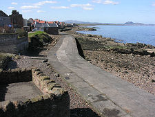
Prestonpans itself had three things going for it from an early date. Its access to the sea made it an attractive place for a harbour; the seemingly endless supply of locally mined coal gave it all the fuel it could ever want; and the salt water of the River Forth was a valuable commodity when the water was evaporated away in salt pans. Hence the name Prestonpans. As early as the 1100s salt was being produced here using locally mined coal to fuel the fires under the pans. It took eight tons of coal to produce one ton of salt: one of the reasons why salt was such a valuable commodity through much of history. The environmental impact of this industry on the shoreline at Prestonpans (and around much of the Firth of Forth) must have been pretty foul.
From the mid 1700s onwards Prestonpans' industrial base expanded. The world's first factory designed to produce sulphuric acid was set up here in 1749. And by the end of the 1700s several potteries were established in the town. These used clay imported from Cornwall, a seemingly strange idea until you realise that each ton of clay needed 12 tons of coal to fire it, so it was far cheaper to transport the clay than the coal.
On 21 September 1745, Prestonpans entered the history books as the site of a battle between Bonnie Prince Charlie's Jacobites and Hanoverian troops under Lieutenant-General Sir John Cope (see our Historical Timeline). The Jacobite victory opened the way for a march that took them as far south as Derby, and which could very easily have led to the replacement of George II by Charles' father as James VIII of Scotland and III of England. In the event, of course, the Jacobites turned back at Derby and were then defeated at the Battle of Culloden on 16 April 1746. The Battle of Prestonpans is now marked by a cairn besides the B1316 and by a nearby viewpoint that offers vistas over the landscape on which the battle was fought.
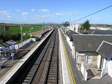
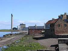
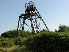
Other aspects of Prestonpans' story have also had mixed fortunes in more recent times. The endless supply of coal eventually ended, or at least stopped being mined. Prestongrange Museum, on the site of Prestongrange Colliery, between Prestonpans and Musselburgh preserves many memories of this aspect of the areas' past. The last salt pan in use at Prestonpans (and in Scotland) closed in 1959. And Prestonpans' once busy harbour fell out of use from the 1930s and has since disappeared.
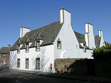
But Prestonpans still rewards exploration. Preston Cross is generally recognised as Scotland's finest mercat (or market) cross; it dates back to shortly after 1617 and still stands in its original location. It is now oddly surrounded by 1900s bungalows but the cross itself remains magnificent. Less well known is the nearby Preston Tower (and doocot). This tower house was the home of the Hamiltons of Preston, the local landowners. It has a number of unique features, the most obvious being that when the occupants decided to upgrade the accommodation in 1626, they did so by simply building a two storey Jacobean house on top of the existing four storey tower. When Preston Tower accidentally caught fire in 1663 the family moved to nearby Preston House and then to Hamilton House. The latter still occupies a prominent corner position near the tower and is in the care of the National Trust for Scotland.
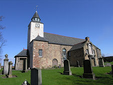
Back in the heart of Prestonpans is Prestongrange Parish Church. Built in 1596, it was one of the first churches to be built in Scotland after the Reformation.
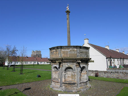 Preston Cross |

|
|
|
Visitor InformationView Location on MapWhat3Words Location: ///prospers.fears.front |
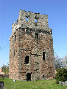 Preston Tower |
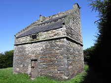 Doocot |
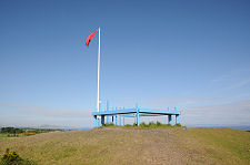 Battle Viewpoint |
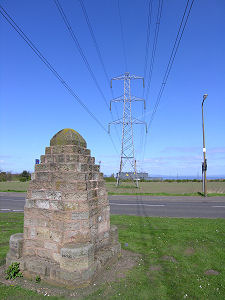 Site of the Battle of Prestonpans |